Home, Sweet Home

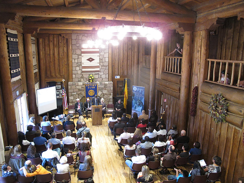
Home —  It’s been three weeks to the day and I’ve arrived back where I began.  On this trip I drove close to 6000 miles as I traveled through 12 states.

I want to thank everyone for your support and interest in my road trip.  I appreciate your comments (keep ’em coming!), and as I was traveling alone, I really enjoyed having you along for the ride!

As I expected, by the time I left Utah I was ready to come home.  When I punched home into the Garmin it said I would arrive by 8:15pm.  Given the time-zone change that translated into 13 hours without stops.   I didn’t think about that, I just decided that 8pm wasn’t that late, and that I’d rather come home to late-night traffic than arrive in Friday afternoon traffic.  So my last day of driving was a long one.   I made it home just before 11pm having pulled out of the RV park near the Utah border at 8:30am (Mountain).

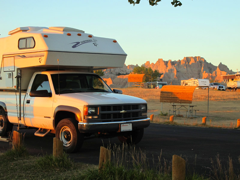
The trip was a complete success.  I suffered no major problems or breakdowns.   This was a great time of year to do a trip like this.  I might have left a few days earlier but otherwise the timing was perfect.  The Garmin only seriously messed up once. The camper performed flawlessly and I used every system including the propane heater (many times) and the 110VAC air conditioner (twice).

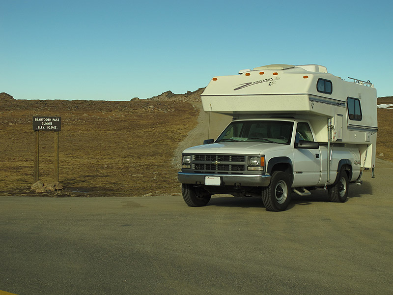
Except for the service engine light which went on and off almost every day, the truck was great.  For a vehicle which mostly sat around doing nothing for the last decade, it enthusiastically started every time I turned the key.   The ride was a bit noisy, but otherwise was very comfortable.   The air conditioner worked the entire trip, and I was very glad I had it repaired before leaving.  Discount Tire provided a free rotation and balance when I passed through Colorado Springs.

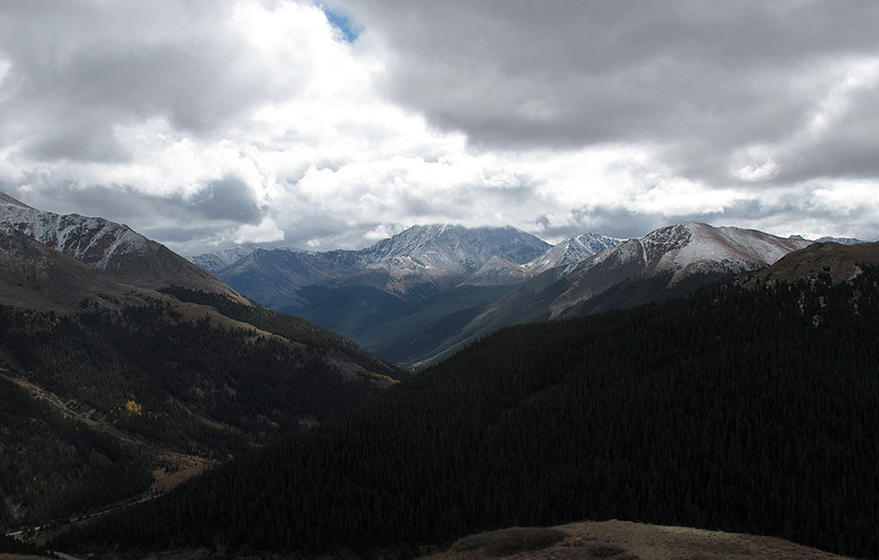
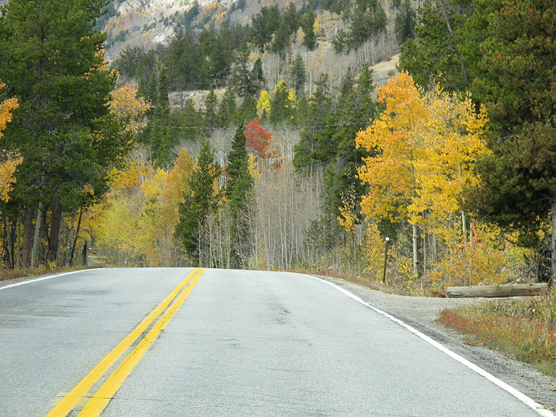
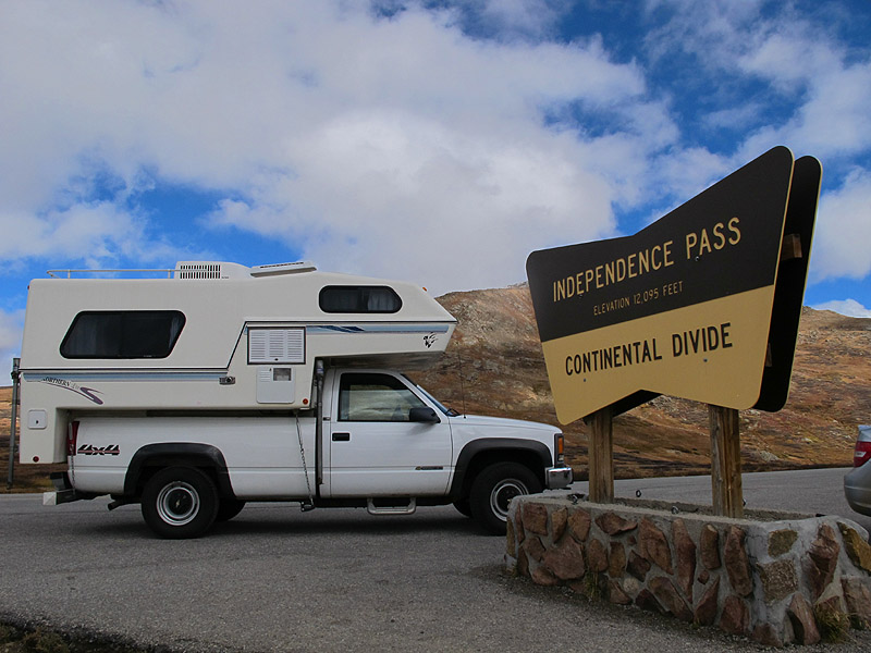
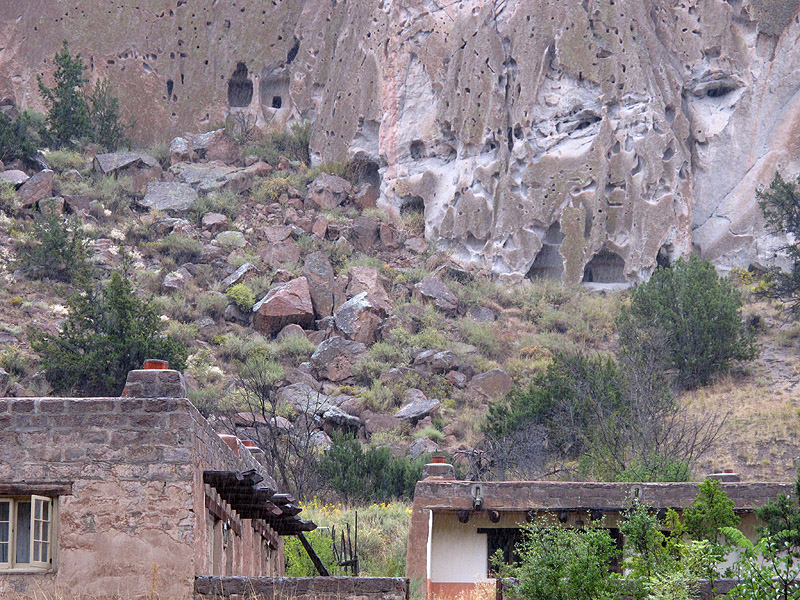
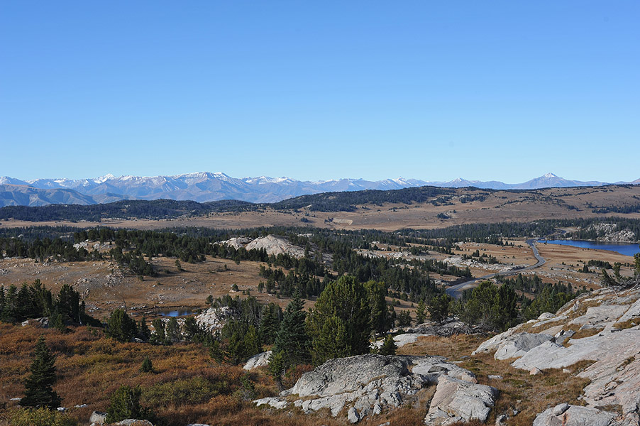
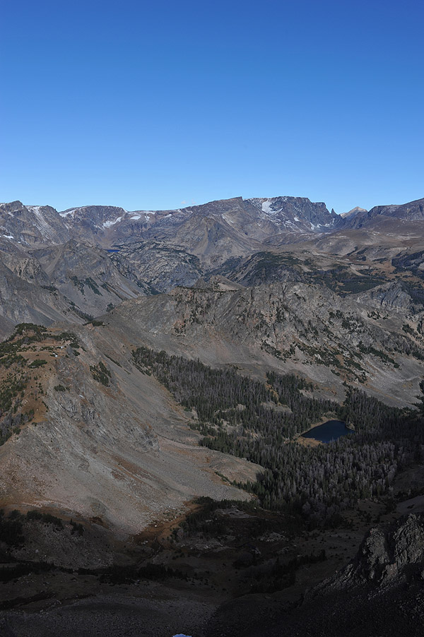
Except for the short thunderstorm in New Mexico, the weather was great the entire trip.  I had a little bit of rain at the start, and used the wipers for short intervals a couple of times.  There was a bit of snow in the shadows at Beartooth Pass, and nothing yet in Colorado, even at Independence Pass.

The only thing I wish I had done before leaving was to upgrade the sound system in the truck.  Lacking a CD player I tried to use a cheap bluetooth speaker with my phone.  That didn’t work as well as I had hoped in terms of both sound and ergonomics.

Buying a month of cell/data service from AT&T turned out to be a very smart thing to do.  It wasn’t flawless, but having internet access more often than not gave me a lot of more options in terms of deciding where I would go next.

I never used my boat’s high-gain wifi antenna.  In my fiberglass camper I was always able to get the RV park’s signal using the WiFi in the computer or phone.

Twice I stayed overnight in Walmart parking lots, both times as my other lodging options didn’t pan out.  I’m grateful to the company for providing me that option.

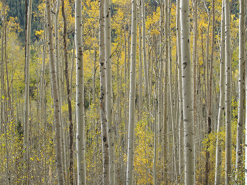
Most of the pictures in this blog were taken with my Canon G11.  I brought my big Nikon, but it wasn’t working well.  The exposures were never right and were always changing.  I finally gave up using it after I decided it was the camera body that was broken, and not the glass.

For us analytical types, here are the final stats:

Miles traveled today: 770 (a record)
Total Miles Traveled: 5837
Total Days:  22
Average Miles per day: 265 (including 3 non-travel days).

Average Lodging: $14.16
Total Lodging $297.40
Total Fuel: $1,139  (averaged very close to 12 mpg)
Total Fuel:  490 gallons
Total Trip: $1436
Average Cost per day: $65.30

I’m quite pleased that my trip costs were under $500 per week. Hotels alone would have cost more than that if I’d driven my car.

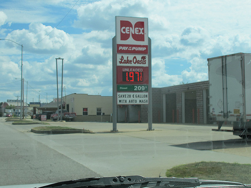
Here’s what I paid for regular unleaded in each state.  As you can see, more than once I paid less than $2 gallon.   The spike was at the south entrance to Yellowstone.


fuelCosts

Here thar be dinosaurs

Snowville, UT —  Not having done any research I would have expected to find dinosaurs in, well, the town of Dinosaur, CO which I passed through after spending the night near Rangely.  Had I turned East on I-40 I might have found some at the Dinosaur National Monument Canyon area Visitor Center.  I instead  went west towards Jensen UT and Salt Lake City.   I only went dinosaur hunting after discovering that the Dinosaur National Monument Visitor Center  was only a few miles off the main highway.  Dinosaurs weren’t on my itinerary — it’s that kind of trip.

NatMonumentSignHad I done any research I wouldn’t have been disappointed by the visitor center because I would have known that the quarry was where they keep the dinosaurs.   All they really have at the visitor center is a 12 minute movie and a gift shop.

Leaving the visitor center in search of dino’s I went on a walk along the “Fossil Discovery Trail”.  Here are a few of the things I discovered on the discovery trail.

Interesting mix of new and old petroglyphs
Backbone
Backbone

This next discovery took a bit to find.  I had to walk up a narrow rock ledge until I could go no further.  Knowing that there had to be something there I looked for several minutes trying to find the “white arrow”  which you can see at the lower, left edge of my discovered backbone in the picture above.   The white arrows are, apparently, what palaeontologist look for when dino hunting.

The discovery below was actually right in front of me, but was hard to see in the rock.  It’s a bit easier to see in this picture because I’ve centered my find, and adjusted the contrast a bit to make it easier to spot.  The tell-tale white arrow has almost completely faded over the last 150 million years.  It’s above the far left edge of the fossil pointing down.

Can you spot the dinosaur fossil?

While on my discovery walk I also spotted a building up on top of a ridge. It looked like another visitor center.  I hiked up there hoping to see at least a bit more than what I saw in the first visitor center.  Having not done any research I honestly wasn’t prepared for what I was about to see.

The building on top of the ridge wasn’t another visitor center containing the usual fossil displays, it was a building which covered the entire quarry — a rock wall containing thousands of fossils.  Way cool!

Am I alone in thinking that you go down into quarries, not up into buildings?

quarry1When the Rockies were formed, it pushed this bit of ground up to the 60 degree angle you see here.  Before then the dinosaurs collected and died here in large quantities at what used to be a river.

quarry2

From the two pictures above you can get a sense of the size of the building.  It’s not small. Click on the picture below for a closer look at one section.  The density of fossilized bones is amazing.

A closer look at one section

This sign helps explain the quarry and building

exhibitSignBeing an obedient guy,  I did as I was instructed…

boneTouchI did eventually find a real dinosaur.

Moving on, I made a family-related stop in Salt Lake City before heading north in search of a bit of family history.  Some of my relatives were well known in the early days of Utah’s state history.

I found it!

IMG_2591(I know what you’re thinking.  It should read Damn Cutler.)

Here’s the dam, what you can see of it.  It’s not large, and access was blocked.  I fully expected black helicopters to appear after I got my camera out and started taking pictures of a dam and powerhouse.  On the other side of the dam is Cutler Reservoir.  Here’s a link to better pictures, and a bit of info about the dam.

IMG_2589

Miles traveled today: 393
Total Miles Traveled: 5067
Average Miles per day: 241

Next stop:  Home


I forgot to bring some John Denver!

Rangely, CO — My previous visits to Colorado always involved driving from the Denver airport to Loveland, Fort Collins, or Colorado Springs  so you might understand why I never really understood John Denver’s passion for the place.   This trip I came up from New Mexico on 285 into Walsenburg,  a pretty drive, and then took 24 out of Colorado Springs to Aspen.  Wow!

I know many of you reading this blog are familiar with I-24, so you might recognize some of these places.    This first picture was taken west of Ute Pass.  Not a lot of trees here!

West of Ute Pass
West of Ute Pass


Fall Colors
Fall Colors

Now, about this time I’ve got a John Denver tune running through my head.  Unfortunately it’s completely wrong.  “Take me home country road” is song about West Virginia!  Oh well!!

I was hesitant to take the road over Independence Pass, because of both the elevation, and the weather.  But having conquered Beartooth Pass I figured what’s another thousand feet?  Except for a few hairpin turns, the road up the east side was pretty easy driving.  The sky ended up being overexposed in these next shots, even when I manually under exposed them by almost two stops.

Road East of Independence Pass
East side, Near the top of the pass

Here’s a couple of shots from the top

View from Independence Pass
Made it! 12,095' elevation
Made it! 12,095′ elevation

Despite having a vehicle length restriction of 35′, I think this road is much easier to drive than Beartooth.  The only challenge was on the west side where, in several places, the road was less than two lanes wide. I could have easily scraped the camper along a rock wall like in this next picture.  I was lucky that I never had to pass oncoming traffic in the narrow bits.  In the picture you can see that they simply stop painting a center line when the road gets narrow.  Notice the skid marks?

narrow road

The aspens were amazing on the west side of the pass

aspenTrees
Aspens
More Aspens

I passed through the town of Aspen, and ended up on I-70.  I then turned north at Rifle, CO and eventually found my way onto highway 64.  This road runs along the White river as it wanders for miles through a beautiful river valley.

White River
White River

Looking for a place to stop along the river I stumbled upon this unmarked campground on a small reservoir near Rangely.  I was hoping to find a place like this.  There wasn’t a sign on the road, just a small sign down off the road that said campground open.  I had the entire campground to myself — it was just me, the fish (they were jumping), and a couple of rabbits.  I’m guessing that if there had been a sign, it might have cut into the business of a couple of RV campgrounds a few miles down the road in Rangely.  It only cost $8 to stay here.

Rio Blanco Water Conservancy


Miles traveled today: 219
Total Miles Traveled: 4674
Average Miles per day: 234

Next stop:  Utah

Answer: 3638 and 15

Los Alamos, NM —  Question:  How many miles and days did Bob have to drive before he reliably remembered to latch the refrigerator door?

Honestly, it’s not that hard, but then neither is remembering to put down the toilet seat.  I’m proud to say that I’ve now gone three days without dumping the refrigerator contents.   I’m not saying it won’t happen again, it’s just that I’m probably now trained about as well as a guy can be trained.

The last time I was in Santa Fe was 40 years ago.  I guess it’s reasonable to expect things to change, but I’m sorry to see what’s happened to the place.  If you haven’t been there recently, imagine Seattle’s University Village in adobe.  Santa Fe used to be a quaint, quiet, rustic place.   Now it’s filled with upscale shops and clogged with traffic jams during all daylight hours.  The population is supposed to be less than 70,000 people yet the town sports Mercedes, Lexus, and BMW dealers.  I was looking forward to spending time in Santa Fe, but once there I couldn’t wait to get out.   I did have a really nice Mexican food dinner at Tortilla Flats.  In fact I have to say that the chile rellenos were the best I’ve ever had.  Unfortunately it’s not a chain restaurant, you’d have to got to Santa Fe to give them a try.

I did do one touristy thing while in Santa Fe.  I went to the Loretto Chapel, home of the “mysterious staircase”.  This particular attraction appeals to the engineer, and sometimes woodworker in me.  You can read more about the interesting history of this staircase on the Loretto Chapel web site.   These next two pictures were actually taken using my cell phone as the battery in my Canon gave out.  I used the cell phone’s high-dynamic range option for the first picture.  The stained glass windows were very bright relative to the lighting in the chapel. Not bad for a cheap smart phone.  Good job Blu!

Loretto Chapel
Loretto Chapel

The staircase is supported in part, in the middle, by a wall anchor that goes into the stone column on the far right in the picture above.  I think I read that that’s a more recent modification.

Loretto Chapel Staircase

I left Santa Fe in the morning bound for Los Alamos. The scenery on the drive up was absolutely stunning in the morning light.

Near Los Alamos
Near Los Alamos

I had toured the Los Alamos National Labs as a high school student.  At the time I remember seeing fusion experiments and some work on solar power.  You can’t get close to the labs now, but the Bradbury museum was nice.  It’s free, and run by the labs.  It’s not that big, but it still took a while to go through.  They have replicas of Fat Man and Little Boy, as well as some of the original equipment used in the 40’s to develop the first atomic bomb.   The Hallicrafter radio and scope below were used to measure the pressure waves to determine yields in atomic test blasts.

Radio and Oscilloscope

The library and bowling alley that were in Los Alamos when I visited in the 70’s are all gone, or are remodeled beyond recognition.   One of the buildings that survived through the years is Fuller Lodge, the main building from the original boys school that was shut down in 1943 to make way for the labs.  It has had some additions.   When I wandered inside I found a US citizenship ceremony underway.  It was fun imagining people like Oppenheimer, Feynman and others in this room.

LosAlamosLodge1
Fuller Lodge Interior

I hadn’t expected to be able to visit “The Black Hole“, a rather unique surplus parts store run by “Atomic Ed” Grothus until his death in 2009.   The shop eventually closed.  I wasn’t even going to try and find the place except that the gentleman at the visitor’s center thought that it had been re-opened.   Re-opened?  Yes!!  Well… it was closed.  All that’s left to buy are shelves according to the guy that was there.  Bummer.

LosAlamosBlackHoleLeaving Los Alamos I went to the Bandelier National Monument.  Unfortunately there were thunderstorms and quite a bit of rain while I was there.  No one left the protection of the visitors center, which is right below some of the Ancestral Pueblo cliff dwellings.  If the weather had cooperated I could have climbed up to these ruins.  If you click to enlarge, and then look closely at the picture below, you can see doorways in the rocks.

Bandelier Pueblo Cliff Dwellings

The Los Alamos area is one place I may have to return to and spend a bit more time.  The natural beauty of this place is amazing.  The picture at the top of this post was taken from the White Rock Lookout Park.  You’re looking at the Rio Grand River and Valley.

Tonight I’m in Blanca, CO.

Miles traveled today: 213
Total Miles Traveled: 4169
Average Miles per day: 245

Don’t mess with Texas

Amarillo, TX — “Don’t mess with Texas”  That’s the first highway sign I saw after crossing into Texas from Arkansas.  The rest of the sign lets you know that you’re not supposed to litter.  What a nice welcome!

I came to Texas to visit more relatives.  They live near Atlanta, a small town not far from Texarkana.  The terrain there is a lot like Missouri and Arkansas, though the hills are less pronounced.  What you can’t see in the pictures are the bugs, and other critters.  There’s a lot of life in these woods!   I almost ran over an armadillo one night.

texas_eastAs I was in Texas to visit relatives  I haven’t done any sightseeing.   I did stop at this “picnic area”  which is Texas’ version of a rest stop, except without rest rooms.

Oil Derrick Picnic Tables

After two weeks, I’m now getting closer to home with each mile traveled.

Today was a rather long drive — my longest so far.  I want to have some time in Santa Fe and hope to be there tomorrow afternoon.  I don’t think there’s much to see here in Amarillo, however there is a scenic canyon just south of here called Palo Duro.  I don’t think I’m going to have time to see it, but I’ll look at the map in the morning

Since this is a rather short posting, and since I’m now headed towards home,  I’ll expand on some of the trip metrics.  In the two weeks I’ve been gone, there are only three days where I haven’t traveled.

Costs to date (10/1/2015)
Total Lodging: $186
Total Fuel: $699
Total Trip: $885
Avg Cost/Day: $59 (fuel and lodging)
Avg Lodging: $12.39  (includes no-fee parks and 4 nights in relative’s homes).

Most expensive gas:  $3.25 at Yellowstone’s South Entrance
Cheapest gas:  $1.89 at a station on the Missouri/Arkansas border.

Miles traveled today: 507
Total Miles Traveled: 3638
Average Miles per day: 242 (includes zero-mile days)

I had hoped that the truck and camper might be a bit cheaper than driving the car and staying in motels (and eating in restaurants).   From the data so far, it looks to be a lot cheaper.  Of course, $2 gasoline helps!

Bad Garmin!

Branson, MO —  I made it!  For a while I wasn’t sure I would.

I had a great time visiting family in the Columbia area.  I really should visit more often!  It’s been a long time since I’ve been able to roll around on the floor with young children.  They even let me play with their toys.

While I was there we also went down to the Lake of the Ozarks which has over 1100 miles of shoreline.  If you’re ever there I can recommend Baxters Lakeside Grill.   It has a very nice decor, and great views from its perch on the hillside.  The food was good, and the prices were much less than what I would have expected given it’s Anthony’s-like appearance.

Baxter's Lakeside Grill
Baxter’s Lakeside Grill
Lake of the Ozarks
Lake of the Ozarks

You might be interested in gas prices.  As I’m burning about 12 mpg,   I certainly am!  Don’t you wish I could bring some back for you?

This is the lowest price I've seen so far
This is the lowest price I’ve seen so far. Too bad my tank was full

So why did I title this post “Bad Garmin!”?   As some of you know I’ve been trying to avoid interstate driving.  It started off well enough.  Here’s a nice little roadside park that I stopped at.

Roadside Park
Roadside Park

Later, on my way to Branson, the Garmin decided I needed to try a little off-roading.  I’ll spare you the details, but I ended up driving about 10 miles on single lane dirt roads until I finally reached a washed-out bridge.  I managed to get the truck turned around and only found my way back to civilization with the help of a nice old farmer, who, with his slow southern drawl, started to tell me all about how the bridge washed out, and how people still keep trying to take that 30 mile shortcut.  He eventually told me how to get to Branson.

While I was on this dirt road I had to: cross streams; slow to a crawl because of low branches; edge my way around a huge (rolled) bail of hay that had been dropped in the middle of the road between the time I first went through and my return; and stop for three deer.  I complain about the Garmin, but it did make for an adventure.  I’m just glad that no one took a  shot at me, or that they missed because of the huge cloud of dust that I was throwing up.

Bad Garmin
Bad Garmin

Miles Today: 277
Total Miles: 2786
Avg Miles/Day: 232 (including non-travel days)

Next Stop, a small town in East Texas

What makes Nebraska Special

Columbus, NE — As I’ve mentioned before, in preparation for this trip I’d asked several people what I should see in Nebraska.  Other than the comment about 2″ steaks, I mostly got blank stares.   The landscape near the South Dakota border was actually quite nice, but was not, admittedly, something one would travel some distance to see.

With 2-inch steaks as my only lead, I decided to have a steak dinner in Columbus.   I finally found the central district, which seemed kind of quiet, but two nice old ladies pointed me to the Husker House.  It was perfect.   The ‘Jack Daniels Sirloin’ wasn’t quite two inches thick, but it was very good, and I kind of like the fact that they don’t appear to have remodeled since 1960.   It was in the Husker House that I discovered what makes Nebraska Special.

Not long after I ordered, a man and his wife sat down with their daughter and son-in-law.  They were there to celebrate a special event.  Almost immediately after being seated they started pulling me into the conversation.   Upon telling them my story about searching for things to see in Nebraska, they too tried to come up with something without much success.   The dinner conversation touched on many other topics as well making for a thoroughly enjoyable meal .  Good food, and great company.

It was getting late.  I finished my meal and was anxious to get going and find some place to stay for the night.   When I went to pay the bill the waitress told me that the gentleman next to me had already paid for my dinner.   It was then that he told me that they may not have much to see in Nebraska, but the people here are really nice.   I told him I couldn’t agree more!   That’s when I understood.  Everyone I’d met, from the two old ladies downtown, to the waitress, to the people at the table next to me had been very friendly.  What makes Nebraska great is the people!

Miles Today: 381
Total Miles: 2099
Avg Miles/Day: 233

The Nebraska sunrise picture at the top of this post was taken near Columbus. I needed to get an early start if I was going to make it to my sister’s house before dark. The sunrise was my reward.

Next stop:  Columbia, Missouri

Excuse me, can you tell me what planet I’m on?

Badlands National Park, SD —   I must have taken a wrong turn coming out of Wall. This doesn’t look like the planet I started on!  Where are the trees, the snow-capped mountains, the lush forests, and the gurgling streams?  And why is the ground the wrong color??

After Montana and Wyoming, the Badlands do feel alien.  That said, I wish I had more time to spend here.  I think I could have spent a week taking pictures along the Badlands Scenic Byway.  There’s so much to look at, but for good pictures I really needed to be at some places at sunrise, and other places at sunset to do the park justice.

badlands3

This was my first time through the badlands.  The terrain was amazing, and so much different than what I’d seen anywhere else.

badlands5

The moon was rising as I neared the east end of the park.  This bit does remind me a bit of planet earth, somewhere in the Southwest.

badlands4They actually have a couple of campgrounds in the park.  What a fun place to stay!  Way more fun than a Marriot Courtyard!

badlands6

Earlier in the day before entering the Badlands I went to Wall Drug, and a Minuteman Missile Silo.

Wall Drug is a famous tourist trap.  I don’t know how many signs Wall drug has along highway 90, but I suspect they have more than one person employed keeping the signs looking nice.   I guess their first sign, back in the day, simply advertized free ice water.

Wall Drug Highway Adverts

I didn’t spend much time in Wall.  The whole town is one long series of shops selling t-shirts, cowboy clothing, food and trinkets.  It was actually quite busy there — lots of cars as well as tour buses full of elderly folks.  I didn’t ask for my free water.

Wall Drug
Wall Drug

The missile silo I visited was a bit of a bust.  The visitors center doesn’t have too much to look at, and the quality of the video they showed wasn’t that great.  The control center might have been interesting, but they only allow 72 people a day to tour “the capsule”, so I would have had to been there around 7AM to get one of the coveted tickets.  The actual silo, which is several miles from the visitors center, takes about 10 seconds to look because there’s nothing to do but peer down into the silo from ground level.   Let me save you the trouble.  This picture is actually better than what you can see by eye because I held the camera out, and against the glass structure covering the silo.  I couldn’t see much without the camera because of the glare in the bright sun.

Minuteman Missile Silo

Next up:  The amazing thing I learned about Nebraska

Miles Today: 196
Total Miles: 1718
Avg Miles/Day: 215

Mount Rushmore and a day off.

Custer, SD —  I’m finally back in civilization, meaning that I have access to WiFi, cell phones, and laundry facilities.  I’ve added several blog posts today in an attempt to catch up.

I’m currently spending my second night in Custer before heading back north towards Wall and the Minuteman missile silo turned national park.  After that I need to point south and make significant progress towards my sister’s place in MO. I’ll probably pass through parts of Nebraska. I don’t know that there’s much to see, but someone at the barber shop told me that you can’t get a steak that’s less than 2″ thick in Nebraska. Armed with that bit of info, there’s no way I’m bypassing that state!

Yesterday I stopped at Mt. Rushmore.   The sculpture is impressive to me, not so much for what it is, but for the scale of the ambition.  It’s quite humbling to compare one’s own accomplishments to both the sculptor and the sculpted.

While I didn’t speak to the gentleman,  they actually had one of the guys who worked on the monument sitting at a table in the gift shop.   It was hard, dangerous work, for which the men earned about $8/day.  That was probably good money at the time.   It’s amazing that no one died in making the monument.  It was certainly dangerous work.

I trekked down to the sculptor’s studio where I saw the 1/12 scale model used during construction.  As you can see from this picture, the sculptor, Gutzon Borglum, could view both the model and the mountain at the same time.  Apparently, the model was regularly modified to accommodate the realities of the rock they were carving into.

Sculptor's Studio
Sculptor’s Studio

This last picture proved a bit of a challenge.  I couldn’t get the exposure right for both  the 1/12 scale model and the real-thing in the window.  I admit, in this instance, to a bit more editing than my other pictures.  Still, this isn’t a composite image, it’s a single picture.  I’ve just had to work to pull out the detail in the shadows.

Here are the stats after my idle day:

Miles Today: 0
Total Miles: 1522
Avg Miles/Day: 217

At this point in the trip my lodging costs are averaging $16 per day. The park that I’m in now for two nights is $15/night with the Passport America discount. The national forest parks that I stayed in before getting here were free, and it cost me $33 for the night in Yellowstone. With fuel, it’s been costing me about $60 per day which is certainly cheaper than hotels, never mind fuel costs.  Food is a don’t-care since I would have been buying groceries anyway.

Beartooth Pass and the Little Big Horn

Red Shale Campground, Custer National Forest —  OK,  I’ll admit it.  I wasn’t sure I wanted to drive over an 11,000 foot pass in an RV.  SteveL had recommended this road, but you have to remember, he did it on a motorcycle.   Still,  I decided the truck and I were up to the challenge of driving over a  pass that’s 200 feet higher than Mt. Baker.  Remember that next time you look at Mt Baker, my truck with camper was 200 feet higher than the top of that volcano.    All I can say is,  it was a blast!  Where else can you drive through alpine meadows and past alpine lakes like the one pictured at the top of this post?  Whoever decided to put this road in is absolutely crazy!

Here’s a shot on the way up the West side

West Side Beartooth Pass

I made it to the top!  It’s pretty cold and windy.  That, and the fact that I my truck doesn’t have a pressurized cabin meant that  I didn’t stay at “the top of the world” very long.

Beartooth Pass Summit, Elev.10,947 feet
Beartooth Pass Summit, Elev. 10,947 feet

Here are a couple of pictures taken on the east side of the pass.  These were not taken from an airplane!

East side of Beartooth Pass

I celebrated my transit with my first restaurant meal of the trip.  I had breakfast at small cafe in the town of Red Lodge, a small town on the Montana side of the pass.

After Red Lodge I made my way to the historic site of the Battle of Little Big Horn.   There’s not much to see beyond a monument and grave markers, though the visitors center does have some of Custer’s belongings and other artifacts.   I’m glad I stopped.  There’s a lot of historical significance to this special place,  and later I couldn’t help but visualize the life of the nomadic tribes as I crossed over the Northern Plains on my way to the Black Hills of South Dakota.

Here’s the view as Custer would have seen it the day he and his men died.  I like the fact that the Park Service noted that both sides fought for what they believed, for their people.  It was nicely balanced.

Custer's Last Stand
Custer’s Last Stand

Next Stop:  Mount Rushmore

Miles Today: 252
Total Miles: 1286
Avg Miles/Day: 257